Find the shortest way in the county.
Desktop Apps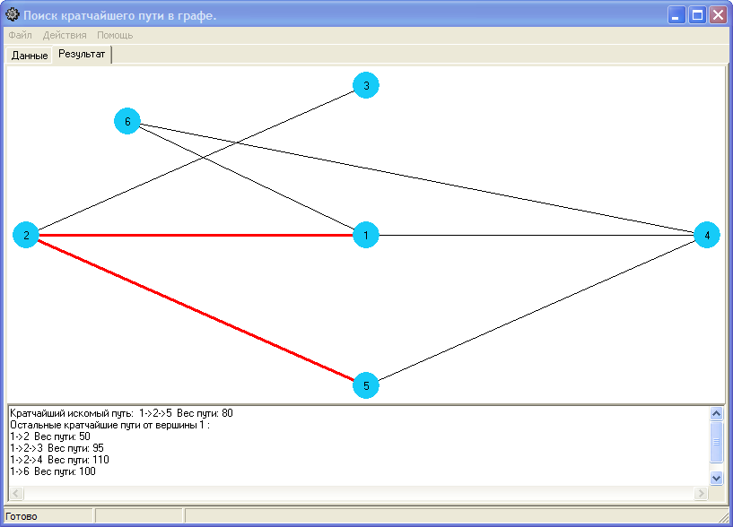
The program calculates and illustrates the shortest path between the two chosen heights in the graph. The area of application, for example, calculate the shortest route between the settlements on the map. Introduction of the matrix of the weight of the reber occurs both from the file and manually into the table. The result is visible, in addition, the program calculates the distance from the first chosen top to all the existing tops in the graph. The result can be recorded in the *.txt file.