DIM CONNECT
DIM CONNECT — Infrastructure Management Ecosystem
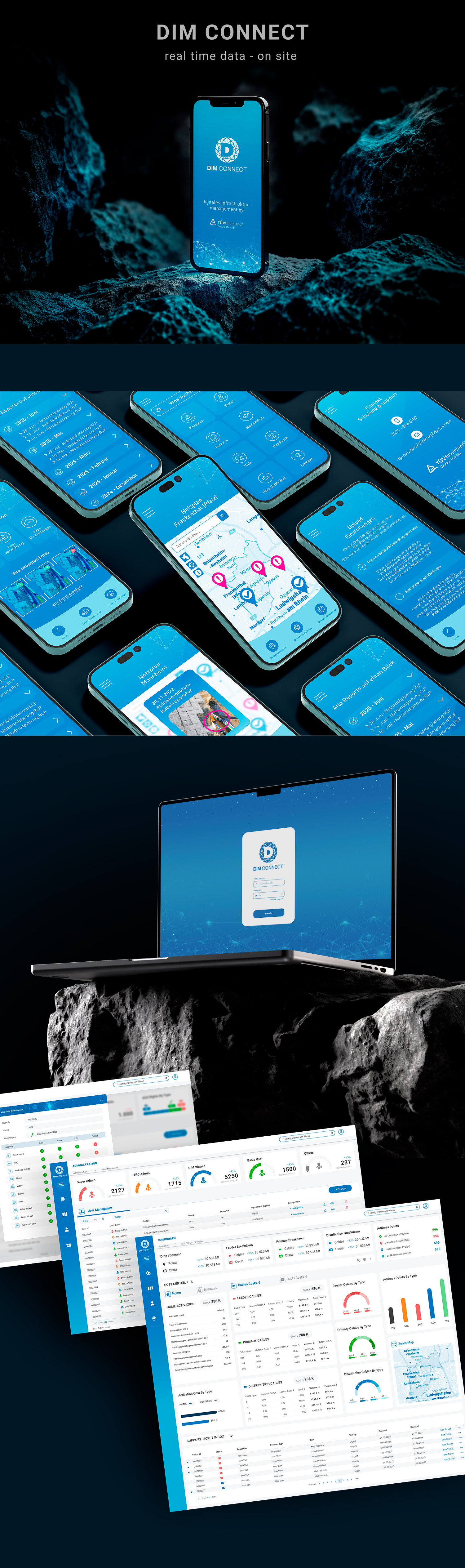
I developed a complete cycle of UI/UX solutions for DIM CONNECT — a cross-platform ecosystem for managing technical infrastructure. The project includes a high-load web management panel for administration and a mobile application for field engineers, creating a seamless workflow between on-site work and office management.
The web management panel is focused on data-driven decision-making. It features real-time analytics, tracking of cable and conduit costs (materials and labor), as well as a multi-level user access rights system. This allows managers to effectively control projects and analyze large volumes of technical data.
The mobile application is designed for use directly on-site. It enables engineers to quickly collect data through photo documentation with GPS tagging, interactive map navigation, and synchronization of regional data.
I also created a unified design system that includes custom icons, graphics, progress indicators, and a professional color palette to ensure visual consistency across platforms.
As a result, a scalable industrial interface was formed that combines field operations with centralized analytics, maintaining clarity, efficiency, and ease of use.
 Kyiv
Kyiv