JS-trip, GoogleMapsv3, animation, markers
Use JS, jQuery, Google Maps V3.
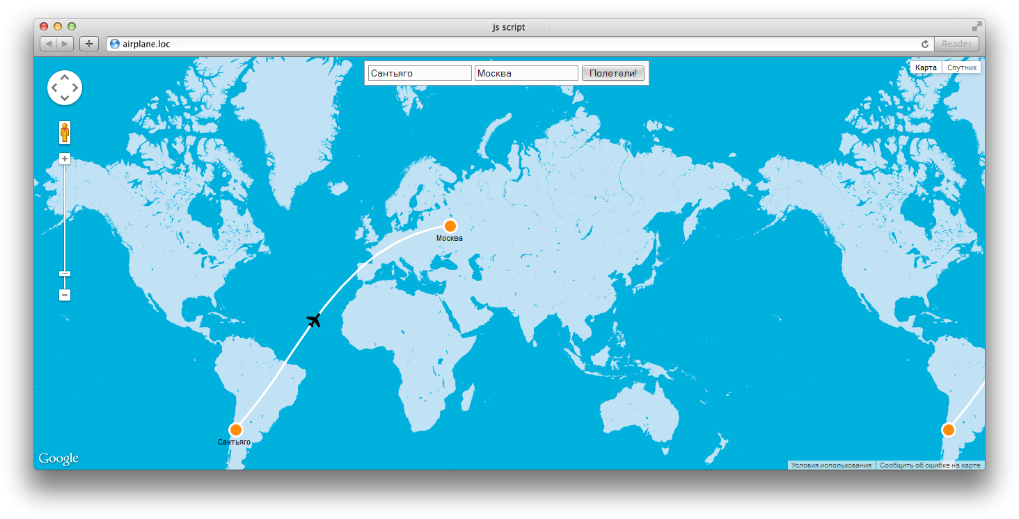
The work done:
Stylization of maps and markers;
The ability to determine the point of departure;
Animation of the markers from point to point;
Drawing the line "polёta" taking into account the geodesy;
use of geolocation API;
Scale within the markers.
The work done:
Stylization of maps and markers;
The ability to determine the point of departure;
Animation of the markers from point to point;
Drawing the line "polёta" taking into account the geodesy;
use of geolocation API;
Scale within the markers.
 Dnepr
Dnepr