Visualization of marine and urban infrastructure - manual reconstruction
This project was not based on uploaded 3D maps from Google or ready-made maps. The port area was manually reconstructed based on real dimensions, satellite images, and photogrammetry, as there was no accurate digital model of this area.
The goal was to create a reliable visual foundation for a long-term coastal development strategy — clear enough for municipal approval, technical enough for engineers, and convincing for tourism investors.
What was created
• A fully custom-made 3D map of the port with real proportions and terrain logic
• Over 2000 structured grids organized for future expansion
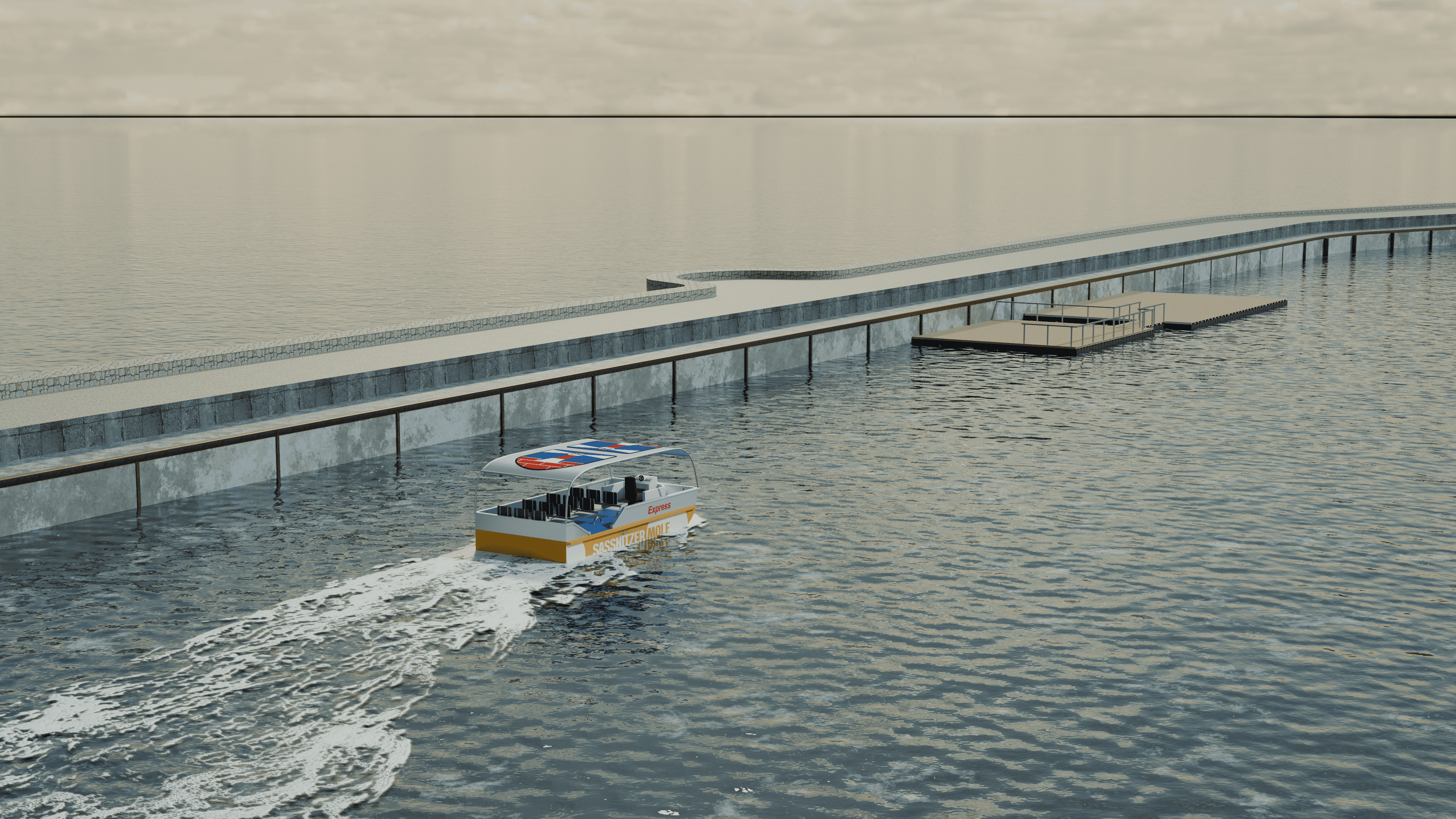
• Six floating platforms manually modeled according to the development concept
• Catamaran routes, pier infrastructure, lighthouse, and breakwater (1450 m)
• Multi-stage visualization of platform evolution:
from passenger hub → to café / office / event space
• Kayak rental area, pontoon bridge concept, urban "teasers"
Technical approach
• Manual reconstruction of the area (without automatic map import)
• 3D photogrammetry used for key buildings
• Clean topology and scalable structure
• Optimization for large scenes and presentation workflow
• Accurate proportions for municipal and engineering review
• Blender-based pipeline
Project scope
• Audience: city officials, land resource administration, citizens, and investors
• Goal: support decision-making regarding the development of tourism infrastructure
The goal was to create a reliable visual foundation for a long-term coastal development strategy — clear enough for municipal approval, technical enough for engineers, and convincing for tourism investors.
What was created
• A fully custom-made 3D map of the port with real proportions and terrain logic
• Over 2000 structured grids organized for future expansion
• Six floating platforms manually modeled according to the development concept
• Catamaran routes, pier infrastructure, lighthouse, and breakwater (1450 m)
• Multi-stage visualization of platform evolution:
from passenger hub → to café / office / event space
• Kayak rental area, pontoon bridge concept, urban "teasers"
Technical approach
• Manual reconstruction of the area (without automatic map import)
• 3D photogrammetry used for key buildings
• Clean topology and scalable structure
• Optimization for large scenes and presentation workflow
• Accurate proportions for municipal and engineering review
• Blender-based pipeline
Project scope
• Audience: city officials, land resource administration, citizens, and investors
• Goal: support decision-making regarding the development of tourism infrastructure
 Kharkiv